Ferrisburgh, Vermont, New England USA
About Ferrisburgh, Vermont
Addison County
Chartered: June 24, 1762 (New Hampshire Grant)
Area: 39,192 Acres = 61.24 Square Miles [ Size Rank: 8* ]
Coordinates (Geographic Center): N 44° 12′ W 73°15′
Altitude: 218 feet ASL
Population (US Census, 2010): 2,775 [ Population Rank: 66* ]
Population Density (persons per square mile): 45.3 [ Density Rank: 99* ]
Full Census Info: Town County State
*Area, Population and Density rankings refer to Ferrisburgh’s relative position among Vermont’s 255 civic entities (9 cities, 242 towns, 4 gores and grants). Complete rankings are here.
Granted the same day as neighboring Charlotte and Monkton and nearby Hinesburg to many of the same people. There were far more Ferrisses listed in this grant, though, and Benjamin Ferriss called the first town meeting. Originally Ferrissburg or Ferrisbourg, the extra letters were soon dropped, just as most of the Ferriss family dropped the extra s.
The main village of Ferrisburg got a post office called Ferrisburgh in 1850. In 1892, the h was dropped, as it was most everywhere in the US at the urging of the postal folk. Recent years have seen that spelling coming back into use for the entire town.
Activities & Points of Interest
Goings-on in and near Ferrisburgh
Calendar of Events provided by the Vermont Department of Tourism & Marketing.
Rokeby Homestead
Home of Rowland Robinson, father of early Vermont history. The 1784 property served as a stop for runaway slaves traveling the “Underground Railway” prior to the Civil War. The times required law enforcement officials to investigate reports of runaway slaves in the area, and that such “property” be returned to its owners. The sheriff was not a friend of slavery but was conscientious in his duty. On his way to look for runaways he would stop at a local pub for “a pint or two” and make sure his destination and purpose were known. Invariably, he would never find what he was “looking for” at Rokeby. Route 7, just north of Ferrisburgh village
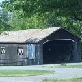
Covered Bridge (With Google Maps and satellite images):
Spade Farm
Click Here for a map of all bridges in Addison County.
Contact Info
Emergency Services (Statewide): 911
Hospital: University of Vermont Medical Center (Burlington) 802-847-0000
Town Clerk: Chet Hawkins PO Box 6 Ferrisburgh, VT 05456
802-877-3429
M-F 8-4
Churches, Ministries, Charitables
United Methodist : North Ferrisburg UMC (North Ferrisburgh) 802-425-2770
Schools
Addison Northwest Supervisory Union 802-877-3332
Ferrisburgh Central School 802-877-3463
Neighboring Towns
This is a basic geographic reference, intended to show relative location of adjacent towns. Directional accuracy is limited to 16 compass points. There isn’t even the slightest suggestion that one can necessarily travel directly from one town to the next (as in “You can’t get there from here”).
FerrisburghLake
Champlain
Utilities
Notes about utilities:
- One electric or phone company indicates that company serves the entire town. More than one of either indicates each serves different areas of town.
- A listed cable company MIGHT mean the entire town is covered, but not necessarily. More than one listed indicates each serves different areas of town.
- Unless your area is one served by Vermont’s only gas utility, your only option is bottled gas (any dealer).
Cable Comcast 800-266-2278
Electric Green Mountain Power 888-835-4672
Telephone Fairpoint 866-984-2001
Telephone Waitsfield & Champlain Valley Telecom 802-496-3391


