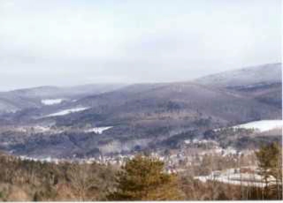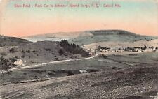
Roxbury, Vermont, New England USA
About Roxbury, Vermont
Washington County
Chartered: August 6, 1781 (Vermont Charter)
Area: 26,690 Acres = 41.7 Square Miles [ Size Rank: 99* ]
Coordinates (Geographic Center): N 44° 06′ W 72°44′
Altitude: 1,007 feet ASL
Population (US Census, 2010): 691 [ Population Rank: 206* ]
Population Density (persons per square mile): 16.6 [ Density Rank: 218* ]
Full Census Info: Town County State
*Area, Population and Density rankings refer to Roxbury’s relative position among Vermont’s 255 civic entities (9 cities, 242 towns, 4 gores and grants). Complete rankings are here.
Roxbury is one of the oldest place-names in New England, used first in Massachusetts in 1630 for a neighbor to (and now part of) Boston, which, after the fashion of the time has been spelled in every conceivable way. Writing in 1634, a townsman suggested that the town was so named because the western side of the town was so rocky. Many historians have pointed out that if it was named descriptively, it was extremely unique for that era.
Nobody has a clear handle on how Vermont’s Roxbury was named. Many of the original proprietors came from Connecticut, where a Roxbury had been incorporated in 1743. There also may have been a lingering fondness for the name on the part of the Vermonters who served under Washington at Roxbury (the Massachusetts one).
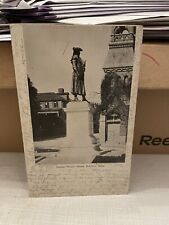
One of the earliest settlers of Roxbury (the Vermont one) was Captain Benjamin Samson, who is said to have rung the church bell at Lexington to warn the Minute Men of the approaching British troops.
Activities & Points of Interest
Goings-on in and near Roxbury
Calendar of Events provided by the Vermont Department of Tourism & Marketing.
Contact Info
Emergency Services (Statewide): 911
Hospital: Central Vermont Medical Center (Berlin) 802-229-9121
Town Clerk: Tammy Legacy PO Box 53 Roxbury, VT 05669
802-485-7840
T-F 9-12 and 1-4
Churches, Ministries, Charitables
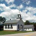
United Church of Christ : United Church of Christ
Schools
Washington South Supervisory Union 802-485-7755
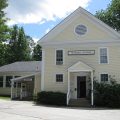
Roxbury Village School 802-485-7768
Neighboring Towns
This is a basic geographic reference, intended to show relative location of adjacent towns. Directional accuracy is limited to 16 compass points. There isn’t even the slightest suggestion that one can necessarily travel directly from one town to the next (as in “You can’t get there from here”).
Roxbury
Utilities
Notes about utilities:
- One electric or phone company indicates that company serves the entire town. More than one of either indicates each serves different areas of town.
- A listed cable company MIGHT mean the entire town is covered, but not necessarily. More than one listed indicates each serves different areas of town.
- Unless your area is one served by Vermont’s only gas utility, your only option is bottled gas (any dealer).
Electric Green Mountain Power 888-835-4672
Electric Washington Electric Co-op 800-932-5245
Telephone Fairpoint 866-984-2001
Telephone TDS Telecom 888-225-5837