Virtual Vermont

Virtual Vermont

  • Home
  • Bridges
  • Towns
  • History
  • Lodging
  • Resources
    • Hiking
    • The Great Moose Watch
    • Vermont Museums
    • Vermont Newspapers
    • Biking in Vermont
    • Chambers of Commerce Business Associations
  • About Us

Lake Champlain

history 

The Native American in Vermont

10612 Views Lake Champlain, Native American, natives

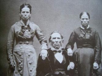
Vermont’s story begins with the indigenous peoples who frequented the territory between the Connecticut River and Lake Champlain long before

Read more
towns 

West Haven, Vermont, New England USA

7606 Views Fair Haven, Lake Champlain, West Haven

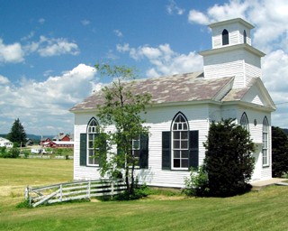
About West Haven, Vermont Rutland County Chartered: October 20, 1792 (Vermont Act of Incorporation) Area: 18,404 Acres = 28.76 Square

Read more
towns 

Charlotte, Vermont, New England USA

13078 Views Burlington, Charlotte, Lake Champlain

About Charlotte, Vermont Chittenden County Chartered: June 24, 1762 (New Hampshire Grant) Area: 32,242 Acres = 50.38 Square Miles [

Read more
towns 

Alburgh, Vermont, New England USA

11924 Views Crown Point Bridge, Esther Munroe Swift, Ira Allen, Lake Champlain

About Alburgh, Vermont Grand Isle County Chartered: February 23, 1781 (Vermont Charter) Area: 30,410 Acres = 47.52 Square Miles [

Read more

Featured Bridges

Cambridge Junction Covered Bridge, Cambridge, Vermont
coveredbridge 

Cambridge Junction Covered Bridge, Cambridge, Vermont

0

Cambridge Junction Cambridge (a/k/a Poland) George W. Holmes, 1887 Burr Arch, 140′, spanning Lamoille River on Cambridge Junction Road, north

Red Covered Bridge, Morristown, Vermont
coveredbridge 

Red Covered Bridge, Morristown, Vermont

0
Bartonsville Covered Bridge, Rockingham, Vermont
coveredbridge 

Bartonsville Covered Bridge, Rockingham, Vermont

0
Pulp Mill Covered Bridge, Middlebury, Vermont
coveredbridge 

Pulp Mill Covered Bridge, Middlebury, Vermont

0

Featured Towns

Franklin, Vermont, New England USA
towns 

Franklin, Vermont, New England USA

0

About Franklin, Vermont Franklin County Chartered: March 19, 1789 (Vermont Charter) Area: 26,196 Acres = 40.93 Square Miles [ Size

Orwell, Vermont, New England USA
towns 

Orwell, Vermont, New England USA

0
Royalton, Vermont, New England USA
towns 

Royalton, Vermont, New England USA

0
Monkton, Vermont, New England USA
towns 

Monkton, Vermont, New England USA

0

Archives

  • August 2018

Recent Posts

  • Proctorsville, Vermont, New England USA
  • Panton, Vermont, New England USA
  • Windsor-Cornish Covered Bridge, Windsor, Vermont
  • Pomfret, Vermont, New England USA
  • Rank Population, Vermont, New England USA

Pages

  • About Virtual Vermont
  • Biking in Vermont
  • Chambers of Commerce Business Associations
  • Covered Bridges in Vermont
  • Hiking in Vermont
  • Lodging
  • The Great Moose Watch
  • Towns in Vermont
  • Vermont Museums
  • Vermont Newspapers
  • Vermont Weddings

Tags

Arlington Battle of Bennington Bennington Benning Wentworth Benning Wentworth's Berkshire Brook Road Burlington Charlotte Chittenden Connecticut Cornwall Covered Bridges England Enosburgh Ethan Allen Ferdinand Ira Allen Lake Champlain Londonderry Lyndon Massachusetts Montgomery Multiple Kingpost New England New Hampshire Orange County Orleans Queenpost Revolutionary War Richford Rockingham Rutland Rutland County Rutland Town Salisbury Savannard Jewett St. Albans Town Thomas Chittenden Timothy Andrews Town Lattice Vermont Wentworth Windham County Windsor County
Copyright © 2025 Virtual Vermont. All rights reserved.