Virtual Vermont

Virtual Vermont

  • Home
  • Bridges
  • Towns
  • History
  • Lodging
  • Resources
    • Hiking
    • The Great Moose Watch
    • Vermont Museums
    • Vermont Newspapers
    • Biking in Vermont
    • Chambers of Commerce Business Associations
  • About Us

Rutland Town

coveredbridge 

Twin Covered Bridge, Rutland Town, Vermont

August 20, 2018August 21, 2018 Vermont2 4862 Views East Creek, Rutland Town, Twin

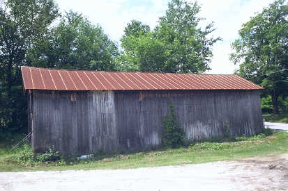
Twin Rutland Town Nicolas Powers, 1850 Town Lattice, 60′, formerly spanning East Creek (just yards from its present location). One of

Read more
towns 

Rutland Town, Vermont, New England USA

August 19, 2018August 21, 2018 Vermont2 3034 Views Benning Wentworth, Farm and full moon, Rutland Town

About Rutland Town, Vermont Rutland County Chartered: September 7, 1761 (New Hampshire Grant) Area: 12,531 Acres = 19.58 Square Miles

Read more
towns 

Rutland, Vermont, New England USA

August 19, 2018August 21, 2018 Vermont2 3849 Views Rutland, Rutland Town, Street Signs

About Rutland, Vermont Rutland County Chartered: September 7, 1761 (New Hampshire Grant) City Incorporated: November 18, 1892 Area: 4,910 Acres

Read more

Featured Bridges

Lower Fairfax Covered Bridge, Fairfax, Vermont
coveredbridge 

Lower Fairfax Covered Bridge, Fairfax, Vermont

August 19, 2018 Vermont2 0

Lower Fairfax (a/k/a Maple Street) Kingsbury & Stone, 1865 Town Lattice, 57′, spanning Mill Brook on Maple Street in Fairfax village.

Scott Cambridge Covered Bridge, Cambridge, Vermont
coveredbridge 

Scott Cambridge Covered Bridge, Cambridge, Vermont

August 13, 2018 Vermont2 0
Chamberlin Covered Bridge, NorthfieldX, Vermont
coveredbridge 

Chamberlin Covered Bridge, NorthfieldX, Vermont

August 20, 2018 Vermont2 0
Green River Covered Bridge, Guilford, Vermont
coveredbridge 

Green River Covered Bridge, Guilford, Vermont

August 20, 2018 Vermont2 0

Featured Towns

Waterford, Vermont, New England USA
towns 

Waterford, Vermont, New England USA

August 15, 2018 Vermont2 0

About Waterford, Vermont Caledonia County Chartered: November 8, 1780 (Vermont Charter) Area: 25,464 Acres = 39.79 Square Miles [ Size Rank: 124*

Grafton, Vermont, New England USA
towns 

Grafton, Vermont, New England USA

August 18, 2018 Vermont2 0
Woodbury, Vermont, New England USA
towns 

Woodbury, Vermont, New England USA

August 19, 2018 Vermont2 0
South Hero, Vermont, New England USA
towns 

South Hero, Vermont, New England USA

August 14, 2018 Vermont2 0

Archives

  • August 2018

Recent Posts

  • Proctorsville, Vermont, New England USA
  • Panton, Vermont, New England USA
  • Windsor-Cornish Covered Bridge, Windsor, Vermont
  • Pomfret, Vermont, New England USA
  • Rank Population, Vermont, New England USA

Pages

  • About Virtual Vermont
  • Biking in Vermont
  • Chambers of Commerce Business Associations
  • Covered Bridges in Vermont
  • Hiking in Vermont
  • Lodging
  • The Great Moose Watch
  • Towns in Vermont
  • Vermont Museums
  • Vermont Newspapers
  • Vermont Weddings

Tags

Arlington Battle of Bennington Bennington Benning Wentworth Benning Wentworth's Berkshire Brook Road Burlington Charlotte Chittenden Connecticut Cornwall Covered Bridges England Enosburgh Ethan Allen Ferdinand Ira Allen Lake Champlain Londonderry Lyndon Massachusetts Montgomery Multiple Kingpost New England New Hampshire Orange County Orleans Queenpost Revolutionary War Richford Rockingham Rutland Rutland County Rutland Town Salisbury Savannard Jewett St. Albans Town Thomas Chittenden Timothy Andrews Town Lattice Vermont Wentworth Windham County Windsor County
Copyright © 2022 Virtual Vermont. All rights reserved.