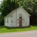
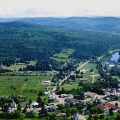
Bloomfield, Vermont, New England USA
About Bloomfield, Vermont
Essex County
Chartered: June 29, 1762 (New Hampshire Grant)
Area: 25,771 Acres = 40.27 Square Miles [ Size Rank: 112* ]
Coordinates (Geographic Center): N 44° 45′ W 71°38′
Altitude: 912 feet ASL
Population (US Census, 2010): 221 [ Population Rank: 233* ]
Population Density (persons per square mile): 5.5 [ Density Rank: 236* ]
Full Census Info: Town County State
*Area, Population and Density rankings refer to Bloomfield’s relative position among Vermont’s 255 civic entities (9 cities, 242 towns, 4 gores and grants). Complete rankings are here.
Granted as Minehead on the same day and to the same group of Connecticut residents as neighboring Averill, Lemington and Lewis. The original name is taken from the town of the same name in England, where many of the families of the grantees had originated.
At the request of townspeople, the name was changed by the Vermont legislature to Bloomfield in 1830. It is often said that the new name also commemorates Bloomfield, Connecticut, but this name predates that one by five years. Two other possibilities: a “made” name chosen for its descriptive connotations, or to honor Joseph Bloomfield, a major in the Revolutionary War and a brigadier general in the War of 1812, during which he commanded a batttalion at the Battle of Plattsburgh, an engagement in which many Vermonters took part.
The population and economy of Bloomfield has risen and fallen over the years. At its height, several hundred men were employed in lumbering and milling operations of the Nulhegan Lumber Company, which owned most of the land around a village then known as South Bloomfield; its location is now marked only by a cemetary. The only settlement to be found in the town today is at the junction of Vermont Routes 105 and 102, in the extreme southern corner.
Activities
Goings-on in and near Bloomfield
Calendar of Events provided by the Vermont Department of Tourism & Marketing.
Contact Info
Emergency Services (Statewide): 911
Hospital: North Country Hospital & Health Care (Newport) 802-334-7331
Town Clerk: Paulette Routhier PO Box 336 N Stratford, NH 05905
802-962-5191
T Th 9-3; and by appt.
Churches, Ministries, Charitables
Methodist : Bloomfield UMC
Neighboring Towns
This is a basic geographic reference, intended to show relative location of adjacent towns. Directional accuracy is limited to 16 compass points. There isn’t even the slightest suggestion that one can necessarily travel directly from one town to the next (as in “You can’t get there from here”).
Bloomfield
New Hampshire
Utilities
Notes about utilities:
- One electric or phone company indicates that company serves the entire town. More than one of either indicates each serves different areas of town.
- A listed cable company MIGHT mean the entire town is covered, but not necessarily. More than one listed indicates each serves different areas of town.
- Unless your area is one served by Vermont’s only gas utility, your only option is bottled gas (any dealer).
Electric Vermont Electric Co-op 800-832-2667
Telephone Fairpoint 866-984-2001


