Huntington, Vermont, New England USA
About Huntington, Vermont
Chittenden County
Chartered: June 7, 1763 (New Hampshire Grant)
Area: 24,539 Acres = 38.34 Square Miles [ Size Rank: 160* ]
Coordinates (Geographic Center): N 44° 19′ W 72°59′
Altitude: 623 feet ASL
Population (US Census, 2010): 1,938 [ Population Rank: 91* ]
Population Density (persons per square mile): 50.5 [ Density Rank: 89* ]
Full Census Info: Town County State
*Area, Population and Density rankings refer to Huntington’s relative position among Vermont’s 255 civic entities (9 cities, 242 towns, 4 gores and grants). Complete rankings are here.
Named New Huntington in the grant, which listed Edward Burling and 65 others, including a number of Ferrises, for whom Ferrisburgh is named. The town is named for three members of the Hunt family among the grantees: Josiah, Charles and Marmaduke. The “New” was dropped by Legislative action in 1795.
The first town’s Post Office was established in 1827 as Huntingdon, and it took fifteen years of protests from townspeople to get the spelling corrected.
It’s actually unusual that it got corrected at all: a number of locations in Vermont are named as they are because of arbitrary decisions on the part of the Post Office and its practice of ignoring the advice and desires of the local populace. Folks in Charlotte and Milton, among others, had similar experiences.
So much of Huntington’s land is mountainous that most of the peaks have not been officially named. Camel’s Hump State Forest takes up much of the eastern portion of the town.
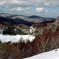
Though many would argue in favor of Mount Mansfield, “The Hump” (pictured above) is easily the most recognizable peak in the state (such that it was used on the Vermont Quarter issued in 2001). Samuel de Champlain called it Le Lion Couchant (The Couching Lion). Natives were somewhat more descriptive, using a term meaning “prudently, we make a campfire in a circle near water and rest at this mountain.” Whatever its name, generations of hikers will attest to the fact that a rest is indeed needed while climbing it.
Activities & Points of Interest
Goings-on in and near Huntington
Calendar of Events provided by the Vermont Department of Tourism & Marketing.
Audubon Nature Center
Not just bird watching. 802-434-3068
Chittenden County Historical Society
Contact Info
Emergency Services (Statewide): 911
Hospital: University of Vermont Medical Center (Burlington) 802-847-0000
Town Clerk: Heidi Racht 4930 Main Road Huntington, VT 05462
802-434-2032
M 7-7; T-Th 8-3
Churches, Ministries, Charitables
Baptist : Huntington Baptist 802-434-4854
Schools
Chittenden East Supervisory Union 802-434-2128
Brewster Pierce Memorial School 802-434-2074
Neighboring Towns
This is a basic geographic reference, intended to show relative location of adjacent towns. Directional accuracy is limited to 16 compass points. There isn’t even the slightest suggestion that one can necessarily travel directly from one town to the next (as in “You can’t get there from here”).
Huntington
Businesses & Services
Rocheleau Appraisal
Fast Friendly Service for Northwestern Vermont
Utilities
Notes about utilities:
- One electric or phone company indicates that company serves the entire town. More than one of either indicates each serves different areas of town.
- A listed cable company MIGHT mean the entire town is covered, but not necessarily. More than one listed indicates each serves different areas of town.
- Unless your area is one served by Vermont’s only gas utility, your only option is bottled gas (any dealer).
Cable Comcast 800-266-2278
Electric Green Mountain Power 888-835-4672
Electric Vermont Electric Co-op 800-832-2667
Telephone Waitsfield & Champlain Valley Telecom 802-496-3391
