
 On eBay Now...
25 Victorian British Topographical & Illustrated Cards/Prints, 19th C. For Sale
When you click on links to various merchants on this site and make a purchase, this can result in this site earning a commission. Affiliate programs and affiliations include, but are not limited to, the eBay Partner Network.

25 Victorian British Topographical & Illustrated Cards/Prints, 19th C.:
$85.00
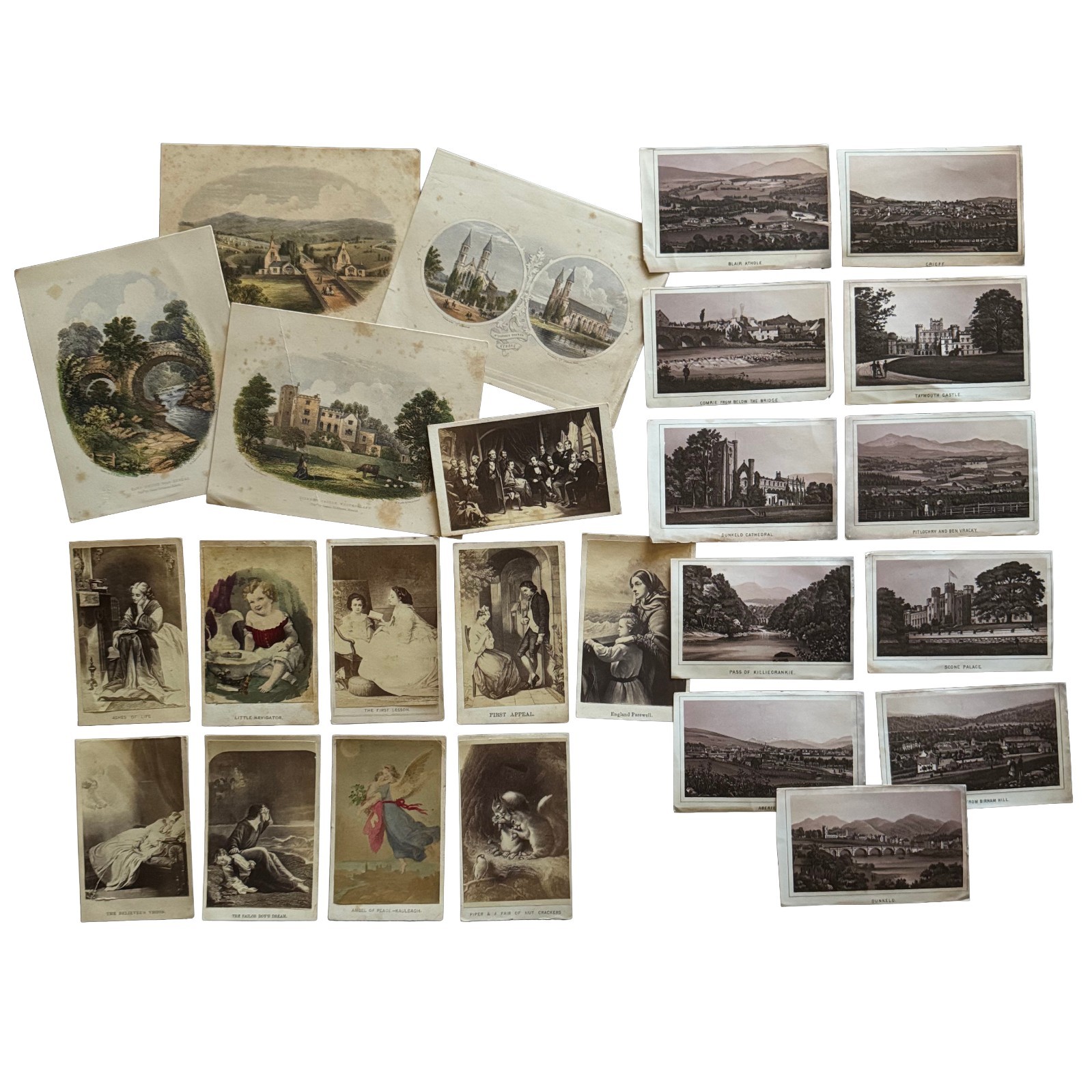
Group of (25) Victorian British Topographical & Illustrated Cards and Prints, 19th C.
Group of (25) Victorian British illustrated and topographical cards and prints, mid-to-late 19th century, comprising three groups of pictorial material relating to England, Scotland, religious and literary subjects, and Victorian genre imagery.
Includes (10) CDV-format illustrated cards, approximately carte-de-visite size, with blank backs. These are printed illustrations rather than photographic portrait CDVs and reproduce sentimental, religious, literary, and genre subjects. Captioned examples include The Sailor Boy\'s Dream, The Believer\'s Vision, First Appeal, England Farewell, Angel of Peace—McCulloch, and Piper & a Pair of Nut Crackers.
Also included are (4) hand-colored topographical prints of Kendal and Westmorland, approximately 5½ x 4½ inches, printed on thin paper with blank backs. Identified subjects are St. George\'s Church, Kendal; Haw\'s Bridge near Kendal; Sizergh Castle, Westmorland; and The Cemetery, Kendal. Period credits represented on the prints include E. M. Edmonds, W. Banks & Son / Banks & Co. of Edinburgh, and J. Robinson of Kendal. These prints appear to date approximately to the 1850s-1860s.
The remaining (11) pieces are small Scottish topographical souvenir view cards, approximately CDV size and printed on thin paper or card with blank backs. The monochrome illustrated views depict Scottish locations including Aberfeldy, Birnam from Birnam Hill, Dunkeld, Dunkeld Cathedral, Scone Palace, Pass of Killiecrankie, Taymouth Castle, Blair Atholl, and Crieff, among other views. The images appear to be printed reproductions of engraved or lithographic views rather than photographs and date to the latter half of the 19th century.
Condition:
Condition varies throughout. Scattered foxing, toning, handling wear, and minor edge wear are present. The four Kendal and Westmorland prints exhibit the most evident foxing.
Explore Our store