Virtual Vermont

Virtual Vermont

  • Home
  • Bridges
  • Towns
  • history
  • Lodging
  • Resources
    • Hiking
    • The Great Moose Watch
    • Vermont Museums
    • Vermont Newspapers
    • Biking in Vermont
    • Chambers of Commerce Business Associations
  • About Us
On eBay Now...

FELCHVILLE, PROCTORSVILLE & SOUTH READING, VT., HAND COLORED 1869 MAP. For Sale
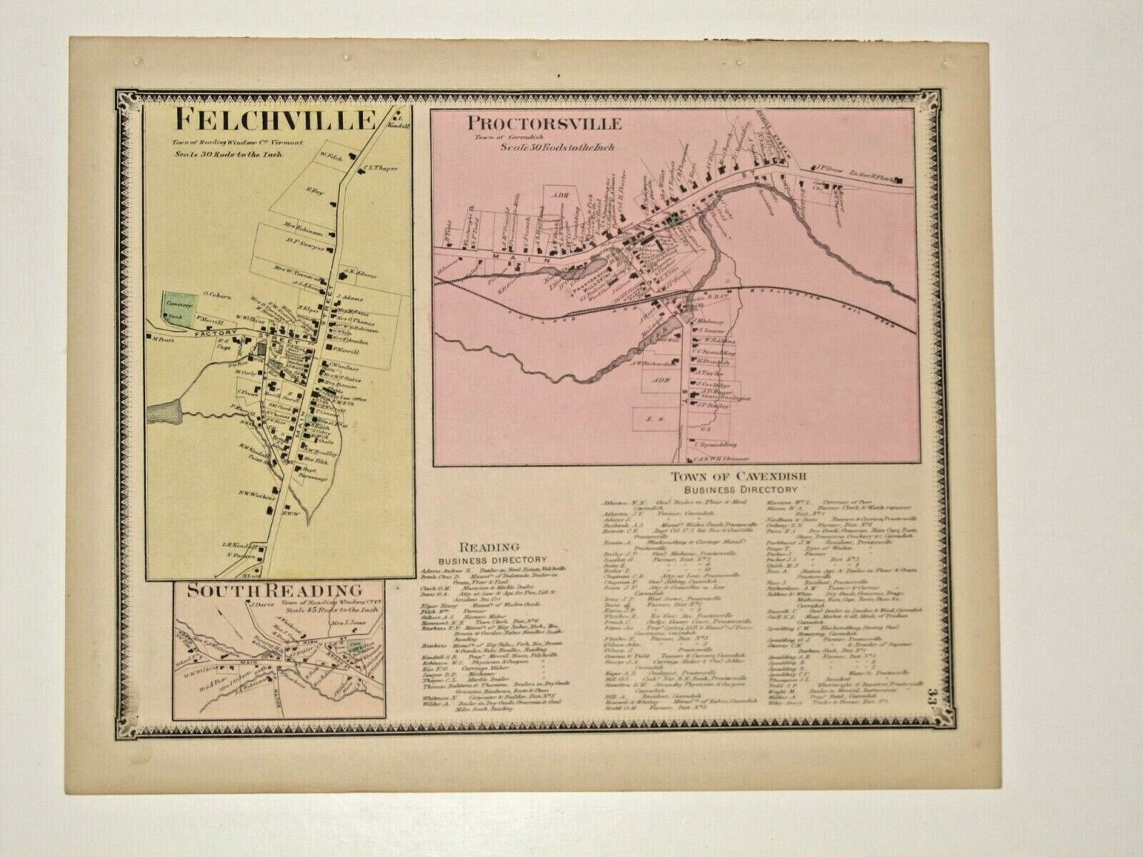
FELCHVILLE, PROCTORSVILLE & SOUTH READING, VT.,    HAND COLORED 1869 MAP.


Buy Now

FELCHVILLE, PROCTORSVILLE & SOUTH READING, VT., HAND COLORED 1869 MAP.:
$30.00

THIS MAP IS IN VERY GOOD CONDITION, THE MAP SHOWS HOME LOCATIONS & GIVES THE OWNERS NAME WHEN THE MAP WAS PUBLISHED IN 1869. THE MAP MEASURES ABOUT 11X14 INSIDE THE BLACK BORDER, PLUS THE BLANK MARGIN AREA. I HAVE INCLUDED A PHOTOGRAPH OF THE TITLE PAGE OF THE ATLAS THAT THIS MAP WAS REMOVED FROM, INDIVIDUAL MAPS ARE NOT DATED, ONLY THE TITLE PAGE IS DATED. THIS IS NOT A REPRINT AND A GREAT BUY AT THIS PRICE.


Buy Now


Featured Bridges

Gates Farm Cambridge
coveredbridge 

Gates Farm Cambridge

March 25, 2023 Vermont2 0

Gates Farm Cambridge (a/k/a Little) George W. Holmes, 1897 Burr arch, 60′ spanning Seymour River on a farm road in Cambridge

Scott Cambridge
coveredbridge 

Scott Cambridge

0
Braley Randolph
coveredbridge 

Braley Randolph

0
Gifford Randolph
coveredbridge 

Gifford Randolph

0

Featured Towns

Vernon
towns 

Vernon

0

About Vernon, Vermont Windham County Chartered: 1672 (Massachusetts Grant) Area: 12,869 Acres = 20.11 Square Miles [ Size Rank: 227* ] Coordinates (Geographic

Killington
towns 

Killington

0
Dummerston
towns 

Dummerston

0
St. Albans
towns 

St. Albans

0

Archives

  • August 2018

Recent Posts

  • Canaan
  • Calais
  • Burke
  • Buels Gore
  • Brunswick

Pages

  • About Virtual Vermont
  • Biking in Vermont
  • Chambers of Commerce Business Associations
  • Hiking in Vermont
  • Store
  • The Great Moose Watch
  • Vermont Museums
  • Vermont Newspapers
  • Vermont Weddings
Copyright © 2018 Virtual Vermont. All rights reserved.