Johnson, Vermont, New England USA
About Johnson, Vermont
Lamoille County
Chartered: January 2, 1792 (Vermont Charter)
Area: 28,932 Acres = 45.21 Square Miles [ Size Rank: 64* ]
Coordinates (Geographic Center): N 44° 38′ W 72°40′
Altitude: 516 feet ASL
Population (US Census, 2010): 3,446 [ Population Rank: 48* ]
Population Density (persons per square mile): 76.2 [ Density Rank: 60* ]
Full Census Info: Town County State
*Area, Population and Density rankings refer to Johnson’s relative position among Vermont’s 255 civic entities (9 cities, 242 towns, 4 gores and grants). Complete rankings are here.
The first named grantee of the town was a son of the famed religious leader, Jonathan Edwards; the second was William Samuel Johnson, for whom the town was named, considered of equal rank to Edwards as an exponent of idealist philosophy in colonial America. For more than half a century, he was active in three fields: jurist, statesman, educator.
A graduate of Yale, Johnson quickly became a leader in the Connecticut Bar, and served several years in that colony’s House of Representatives and on its council. He was the colony’s Representative to England, later to the Continental Congress. He was a member of the convention that wrote the US Constitution as well as one of Connecticut’s two signatories to that document. Upon leaving government service, he became the first president of Kings College in New York, now Columbia University.
Johnson is in the Green Mountains of Northern Vermont, just minutes to Smugglers Notch and Stowe.
The town is perhaps most well known as the location of Johnson State College and Johnson Woollen Mills, but also has a rich tradition of farming and horses. The village of Johnson is home to a number of antique shops, several small eateries, gift shops, world-class craft producers and an art school.
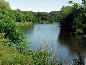
The Gihon River joins the Lamoille River here on its journey to Lake Champlain; both are excellent trout water. Johnson reflects the beauty, clean water, and rich soil of all of Lamoille County.
Activities & Points of Interest
Goings-on in and near Johnson
Calendar of Events provided by the Vermont Department of Tourism & Marketing.
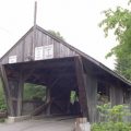
Covered Bridges (With Google Maps and satellite images):
Power House Scribner
Click Here for a map of all bridges in Lamoille County.
Contact Info
Emergency Services (Statewide): 911
Hospital: Copley Hospital (Morrisville) 802-888-4231
Town Clerk: Rosemary Audibert PO Box 383 johnson, VT 05656
802-635-2611
M-F 7:30-4
Churches, Ministries, Charitables
Mormon : Church of Jesus Christ of Latter Days Saints 802-635-2009
Nazarene : Church of the Nazarene 802-635-2988
Nondenominational Community Church: United Church of Johnson 802-635-7249
Roman Catholic : St. John the Apostle
Schools
Lamoille North Supervisory Union 802-888-3142
Johnson Elementary School 802-635-2211
Johnson State College 802-635-2356
Neighboring Towns
This is a basic geographic reference, intended to show relative location of adjacent towns. Directional accuracy is limited to 16 compass points. There isn’t even the slightest suggestion that one can necessarily travel directly from one town to the next (as in “You can’t get there from here”).
Johnson
Utilities
Notes about utilities:
- One electric or phone company indicates that company serves the entire town. More than one of either indicates each serves different areas of town.
- A listed cable company MIGHT mean the entire town is covered, but not necessarily. More than one listed indicates each serves different areas of town.
- Unless your area is one served by Vermont’s only gas utility, your only option is bottled gas (any dealer).
Cable Comcast 800-266-2278
Electric Johnson Water & Light Department 802-635-2301
Electric Vermont Electric Co-op 800-832-2667
Telephone Fairpoint 866-984-2001

