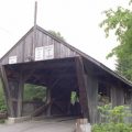
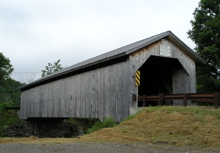
Hopkins Covered Bridge, Enosburgh, Vermont
Hopkins Enosburgh

Sheldon & Savannard Jewett, 1875
Town Lattice, 80′, spanning Trout River on Hopkins Bridge Road, adjacent Route 118, 2.3 miles east of East Berkshire.
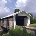
Hopkins Enosburgh
Sheldon & Savannard Jewett, 1875
Town Lattice, 80′, spanning Trout River on Hopkins Bridge Road, adjacent Route 118, 2.3 miles east of East Berkshire.
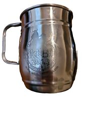
2013 Wild Bill's Olde Fashioned Soda-Pop Johns Hopkins Stainless Steel Mug
$14.99
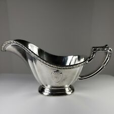
Vtg MARK HOPKINS Hotel SF Heavy EP Silver Soldered GORHAM Gravy Sauce Boat HTF
$298.00
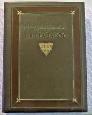
JOHNS HOPKINS University 1939 HULLABALOO YEAR BOOK 50th Edition
$30.00
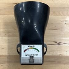
Vintage Hopkins Model C1 Motorcycle Headlamp Intensity Meter Works
$85.66
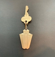
The Mark Hopkins Intercontinental Hotel San Francisco, CA Hotel Room Key #1124
$25.80
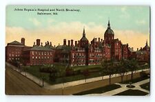
Johns Hopkins Hospital And North Broadway Baltimore Maryland Vintage Postcard
$4.50

Fenton Plum Purple Crest Double Crimped 6 1/2" Vase S Hopkins Artist Signed
$69.99
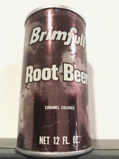
Brimfull Soda Can - EMPTY, 12oz - Root Beer Soda - Pop CAN, Hopkins, MINN. 55343
$20.00
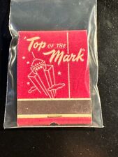
MATCHBOOK - TOP OF THE MARK - HOTEL MARK HOPKINS - SAN FRANCISCO, CA - UNSTRUCK
$12.99
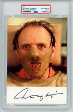
Anthony Hopkins ~ Signed Hannibal Lecter Silence of the Lambs Autograph~ PSA DNA
$595.00